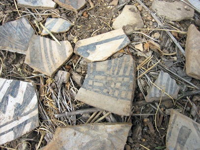
Los Alamos County stretches across the Pajarito Plateau on a landscape that in the early 1900s was proposed as a National Park to protect the thousands of cultural resource sites found here. About 150 cultural sites have been identified on county open space. These sites include multi-story pueblos, small room blocks, game pits, lithic scatters, sheepherder shelters and corrals, and rock art sites.
All cultural resources, including all artifacts, are protected by Federal law and should not be moved, damaged, taken, or disturbed.
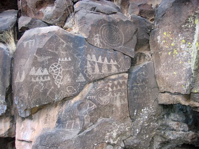
Thousands of petroglyphs are found of the rocks in White Rock Canyon, so many the the canyon is listed on the National Register of Historic Places. Careful observers will find rock art panels along the major trails in the canyon.
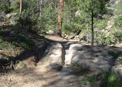
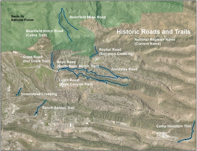
Many trails on the Los Alamos Trail Network are historic roads built by homesteaders on the Pajarito Plateau. The homestead roads were constructed to accommodate wagons. A number of physical attributes were common to all. Most surviving roads are located on steep slopes, generally on the north-facing sides of the canyons. In this area, the south-facing walls are primarily sheer cliffs. Road grades could be steep- up to 18 percent in short sections. The inside wall was excavated with no shoring or erosion control, even though the excavations could reach as much as 3 meters in height. Often, large boulders or bedrock had to be cut to accommodate the roads. The cuts were made with metal picks; characteristic fluting formed by the parallel pick marks is common along the roadsides. The homesteaders built crude rock embankments on the outside edges of the roads along the canyon sides. Most embankments show some low course work. However, where the banks became steep and high, better grades of coursed rock walls were built. Many roads were built along sections of bedrock, which retains ruts worn by numerous wagon trips. Most ruts have been widened by horse, foot, and bicycle traffic.